


See the field. Run the farm.
How it works


.svg)

Plant counts, weed maps, and crop data delivered the same morning.
The data builds season over season, specific to each farm.
The data builds season over season, specific to each farm.

How it works
Three steps. Works from the first flight.
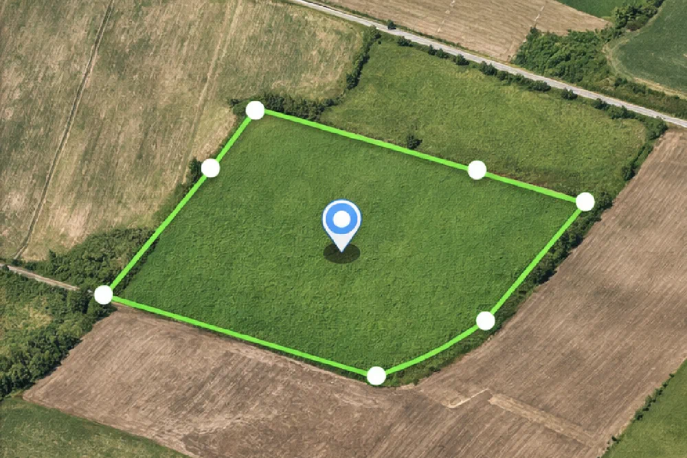
Mark
Mark each block as you plant
As each block goes in the ground, mark the boundaries with the provided device and the VegForecast™ app. Takes a few minutes. VegForecast knows that block from that day forward.
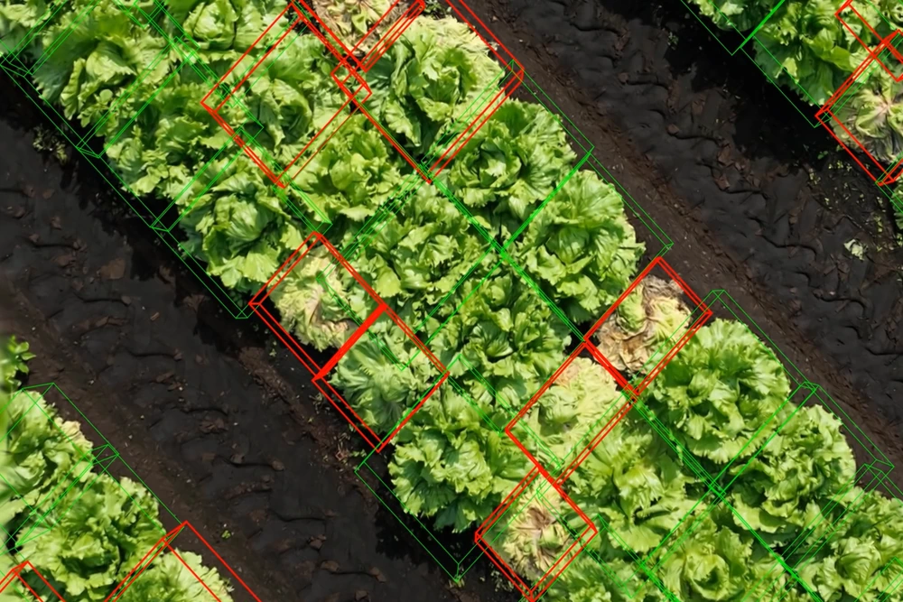
Fly & Scout
Drone flights and field scouting, every cycle
Regular flights follow a standardized protocol, giving you consistent plant-level measurements every time. VegForecast™ generates the flight plan. The grower's team or a service partner flies it.
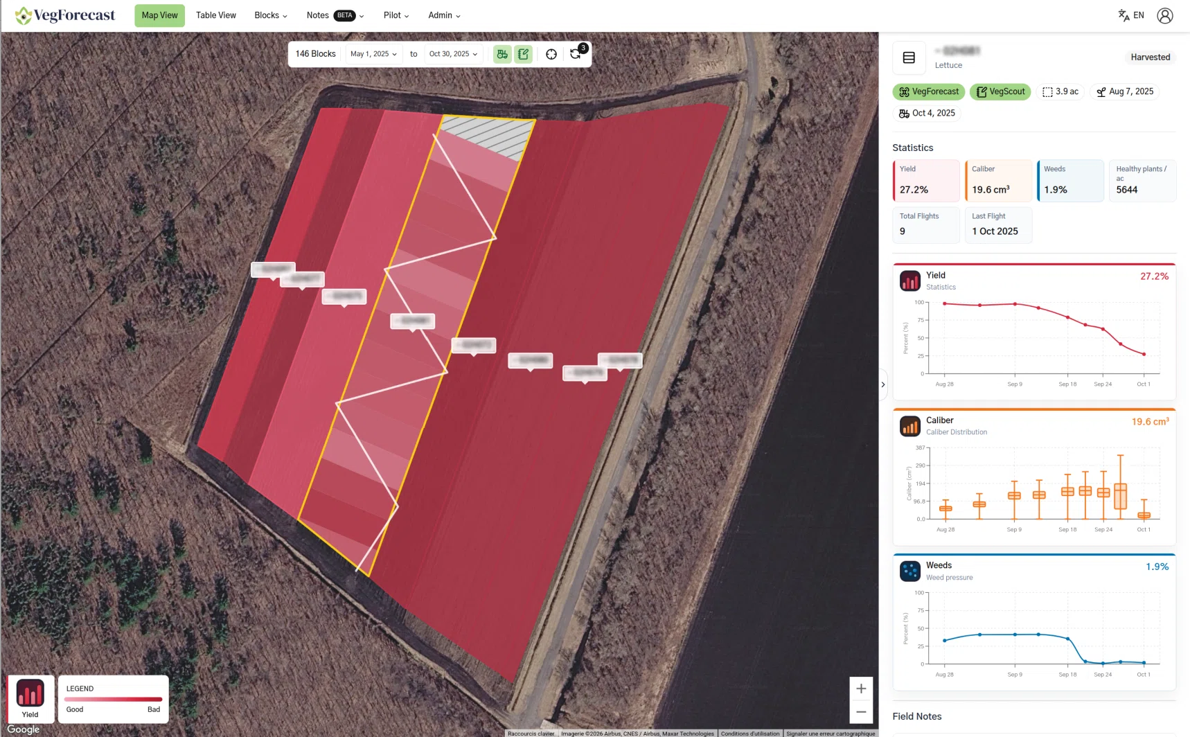
Decide
Decisions, same morning
Within an hour, VegForecast™ delivers plant counts, marketable plants per acre, weed zone maps, and growth indicators. Shared automatically with your field crew, agronomist, and sales team.
Benefits
What changes when you can see every acre, every flight.
Frequent field insights
Each flight turns the field into actionable data: stand density, crop growth, weed pressure, and zones to watch, so your team can track what changes between field visits.
Sharper every season
Each flight adds to a growing picture of your farm. VegForecast™ combines plant measurements, rotations, weather data, and field notes into indicators that get more precise with every cycle.

From the field to the buyer
Plant counts, weed maps, and scouting notes flow through one platform, shared across the field crew, the agronomist, and the sales team. Everyone works from the same picture.
Book a field demo
In Action
Trusted by farms across Canada. Entering California in 2026.
See it in your field
Email:
info@innoptech.comDescribe your situation and objectives, and our team will get back to you shortly.
Partners and investors, you can also reach out to us here.
Partners and investors, you can also reach out to us here.

